Saturday, January 13, 2024

Ortrand, Großkmehlen, Lindenau, Hoyerswerda, & Spremberg (21/10/2023)

On a still rather warm late October weekend, I decided to do a day trip from Berlin and head to the southern tip of Brandenburg. My first stop was the town of Ortrand which I reached after a switch of trains. Once there I headed through the small old town and reached the central square, the Markt. Here were some old buildings, including the town hall, and a nice refurbished saxon milepost from 1730 at its center. Walking through town I reached the main church, dedicated to St Barbara, featuring a baroque style but unfortunately closed when I tried entering it. At that point, I decided to head out of town and walk southwards, initially through some open countryside and later through a nice thick forest. After a bit of walking, with the final stretch all uphill, I reached the top of a small hill called the Kutschenberg. Although not isolated, but rather part of a low hill range on the border with Saxony, this is considered Brandenburg's highest hill at 201m above sea level. Due to the trees and surrounding hills, many of which were higher, at least on the Saxon side, the view wasn't anything worth it, but at least I had reached the region's highest natural point. I continued along the ridgeline, enjoying the nice view once in a while and the trees gave way to some open patches of land. At one point I decided to head back northwards, this time walking to the next village, Großkmehlen, close to Ortrand. As I approached it, I was happy to feel the strong and warm sun behind my back. I passed by the main church, St George, rebuilt in the 17th century and reached then the highlight of the place, the Schloss Großkmehlen. This castle was originally built in the 13th century but turned into its current baroque style during the 17th and 18th centuries. It features a central square plan and is surrounded by a moat and is thus considered a water castle. Unfortunately, as I reached the castle I found it closed so that meant continuing on my walk. I advanced further north, along a nice path sided by open countryside along the Pulsnitz River. After a while, I reached the village of Lindenau, and immediately approached its castle, Schloss Lindenau. This one was quite run down, with its exterior plasterwork falling off, and overgrown vegetation around. However, despite that, its baroque opulence was still a sight to behold. Right in front of it, was the baroque gatehouse leading to the main street of the village. On the other side of it were the 17th-century castle church and some nice farmers' houses. From there it was time to head back from where I had started. I took another route, following some paths through open fields and then over the autobahn as well. Eventually, I came back to Ortrand and here headed towards the train station after a nice loop hike. Once there, I took a train and reached the next town on my trip, Hoyerswerda, a few kilometers to the east, and part of the state of Saxony. After getting off the train, I headed through the old town, part of which had been preserved alongside the new town built after WWII under the German Democratic Republic. Particularly nice was the Lange Straße, a street once running on the inside of the medieval walls encircling the city, with some well-preserved 18th-century low townhouses. Moving on I reached the main square with the town hall, built in the 15th century and restored in the 17th century, and a Saxon milepost. Nearby I walked by the Schloss, a small baroque castle with inside the city museum, and around it the local zoo. Quite sad was the bear pit right below the building, on what was once the castle's moat. Finish off my walk around town I passed by the church of St John, a late gothic building which was closed when I tried entering. At that point, it was time for the last town of the day, Spremberg, which I reached with a short train ride. Once there, I walked through the old town, partly surviving with some historic parts and partly rebuilt after WWII. I first reached the main square, where the town hall is located with its nice 18th-century tower similar to that of a church. Walking onwards I reached the Kreuzkirche, a nice late gothic church dating to the 14th century with a tall tower topped by a spire in front a bit to the side. Continuing on my walk through town I then passed by the Schloss, a simple square castle originally dating to the 11th century but refurbished from the 18th century onwards. Today it holds the city museum which was closing just as I arrived there. Moving on, I walked through the nearby city park extending also up a hill. On top of it was the Bismarckturm built at the beginning of the 20th century. From there I enjoyed a nice view of the old town from above and a golden sunset to crown the nice and warm day. 
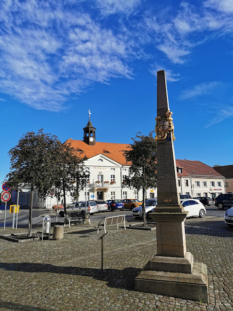
Ortrand's main square

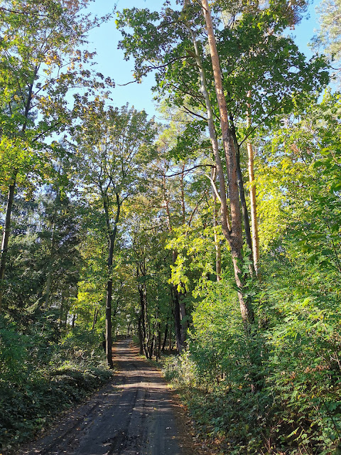
The forest around the Kutschenberg

Some friendly sheep

The nice open countryside

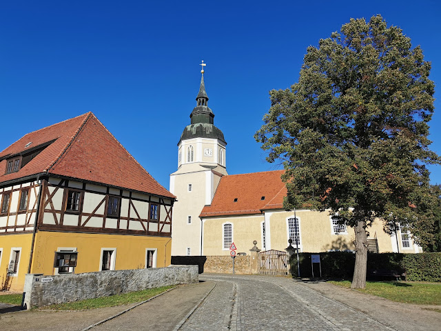
Großkmehlen's church

Schloss Großkmehlen

On the way to Lindenau
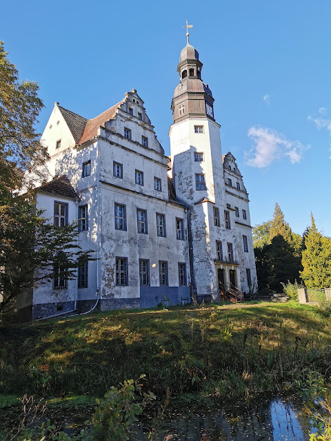
Schloss Lindenau

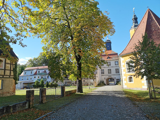
The castle church and gatehouse

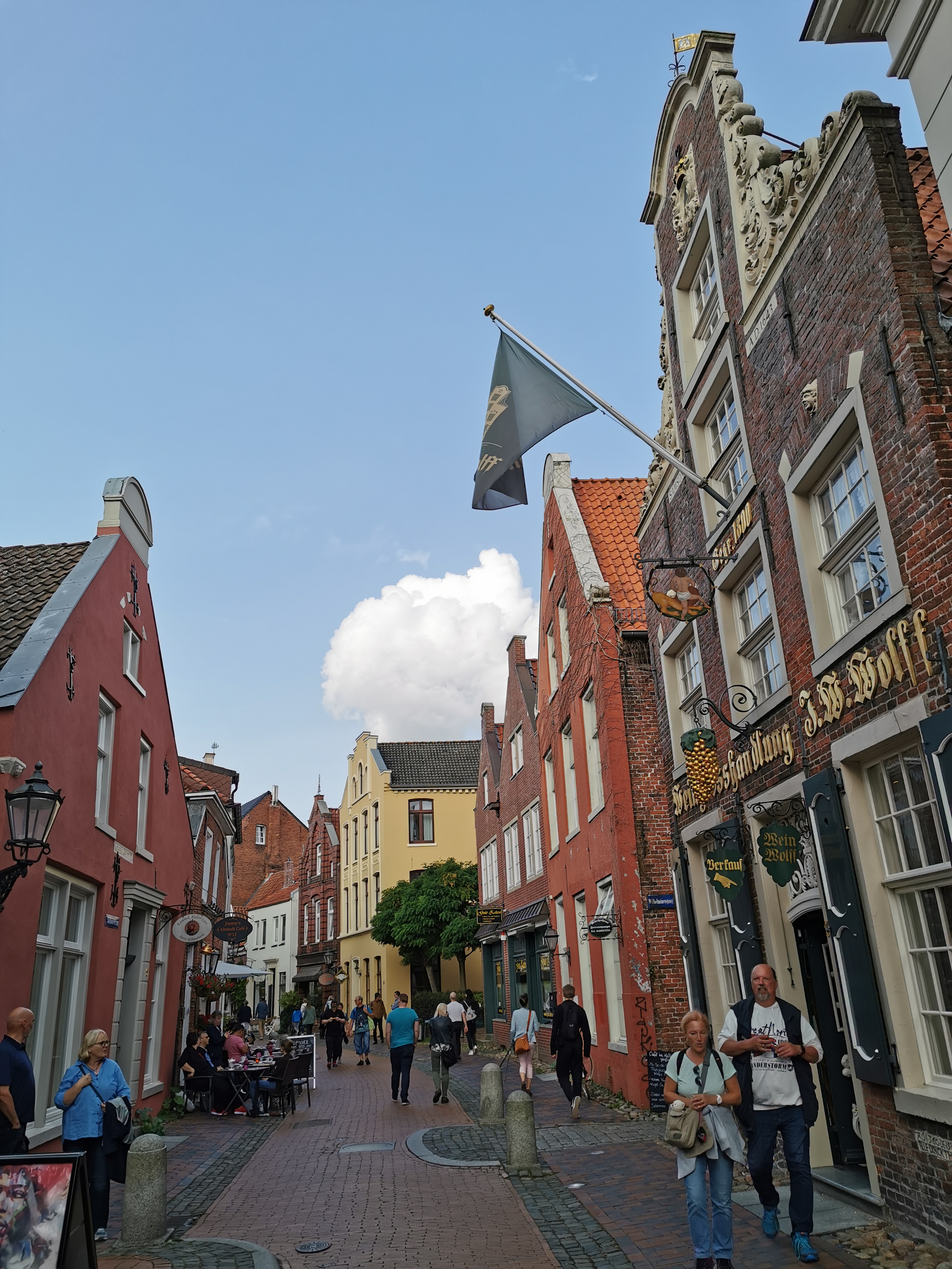
Hoyerswerda's old town
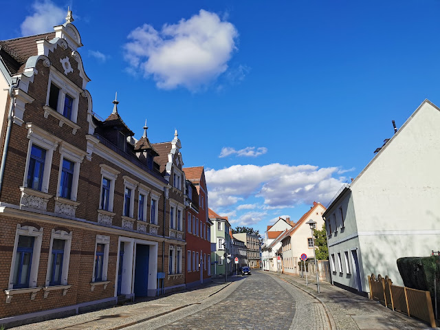
The Lange Straße

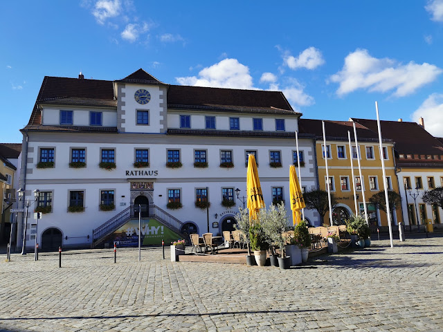
The town's main square

The Kreuzkirche in Spremberg

Schloss Spremberg

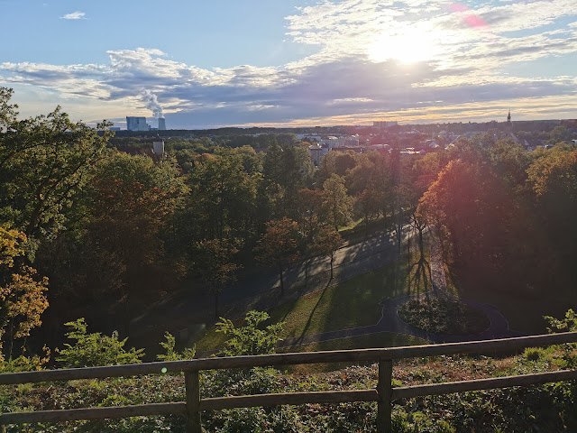
View of the town and city park


Monday, January 8, 2024

Croda da Lago hike (14/10/2023)

On an October weekend, my brother and I decided to go hiking in the Dolomites to see some fall foliage. We woke up early and left Vicenza, driving north for a couple of hours to reach the town of Cortina d'Ampezzo. Once there we drove further up to reach a parking lot along the road to Passo Giau. We parked the car and started our trail at 1458m above sea level, heading straight uphill through the forest. The day promised good, with a clear blue sky and despite the altitude and late season not so cold yet. As we gained altitude we started having a beautiful view of the surrounding landscape and mountains. After a bit of walking, we started coming across other hikers, some coming from other trails which all join on one spot to continue upwards. About halfway up we then came across a vantage point from where we had one of the most beautiful views ever. Westwards we could easily make out the rocky outcrop of the Cinque Torri; to the north the Tofane, Pomaganon, and Cristallo mountains; and to the east the Faloria and Sorapiss. At its center surrounded by these beautiful mountains, down below in the valley was the town of Cortina, in my opinion, one of the nicest places ever due to its geographic location. After enjoying the magnificent scenery we continued onwards, and after a bit more walking eventually reached the Lago Federa, an alpine lake at about 2038m. All around it were beautiful yellow larches and green pines and spruces which came even more alive and bright under the morning sun. The lake is also closed to the west by the tall wall of the Croda da Lago mountain massif. To the south, in the distance, set in a scenic location, is the Becco di Mezzodì with its peculiar shape like that of a rhinoceros horn. As we walked around the lake we admired the beautiful scenery and were captivated by its turquoise-colored waters. Having completed the round of its perimeter we then decided to follow a steep path up the side of the mountain to get up at a higher altitude and admire the scenery. That was an excellent choice because now we were able to have a beautiful view of the lake below and the mountains to the east, including Cristallo, Sorapiss, and Antelao. We were getting hungry and decided to head to the mountain hut located on the shore to the south of the lake. Here we ordered some food, I got three different types of canederli while my brother took polenta with cheese. We sat outside but by the time we were done, the sun was now mostly covered by a thick veil of clouds. After lunch it was time to move on; we decided to take the longer route around the Croda da Lago massif and head down towards the car from the other side instead of the same way we had come up. We walked uphill until we reached the Forcella Ambrizzola, right below the Becco di Mezzodì. Here we had a great view despite the clouds of the mountains to the south, including the notorious Monte Pelmo. Heading then west and north we walked further up to reach Forcella de Formin at nearly 2490m. We were now on the west side of the Croda da Lago and from there had it all downhill towards our car. The way was quite hard and it was all over rocky terrain with big and small boulders all around. The path required a lot of attention to where to put our next step as some rocks were also loose and some sections steep. After a while, the sun decided to come out once again briefly and granted the scenery a nice afternoon glow. As we descended down the sort of canyon we eventually came across trees, as we had reached an altitude where they were able to grow again. There were more larches and spruces with their beautiful yellow and green colors. Continuing onwards we eventually joined back to the path we had originally taken that same morning. With some more hiking, we got back to the car and were ready to drive all the way home after a successful hike.

View of the Tofane

Cortina and Monte Cristallo

Federa Lake

The lake and the mountain hut

The lake from above with Cristallo and Sorapiss

The lake and the Becco di Mezzodì

The Becco di Mezzodì

View of the Croda da Lago massif

View towards the south and Monte Pelmo

The western side of the Croda da Lago

Fall foliage


Thursday, January 4, 2024

Zevio & Cologna Veneta (13/10/2023)

Coming back from Verona airport after having dropped Ania off, I decided to stop at a couple of places along the way. The first town was Zevio which I reached shortly after. I parked in the main square, Piazza Santa Toscana, and then headed to the Villa Sagramoso, nearby, also known as the castle. In fact, up until the 17th century, it was a fortified structure with a main keep tower and a moat surrounding it which still exists to this day. In the 1600s it was then turned into a palace and villa and modified and expanded to fit its new needs. Nowadays the structure holds the town hall and its offices and can be accessed up to its courtyard. Walking around the former castle's moat I reached the main church, dedicated to St Peter. It was originally built during the 12th century but then refurbished and rebuilt in the 16th century, before once again being rebuilt and getting its current neoclassical form in 1840. Only the bell tower still dates to that 16th-century reconstruction. Once I had walked around the area I got back in the car and drove forwards, stopping quickly to visit a nice church along the way, the church of Scardevara. It was built during the 12th century and still preserves the Romanesque facade and the apse from that period with nicely decorated capitals. The rest of the church was refurbished later, including the Gothic bell tower and the interior from the 17th and 18th centuries. After the brief stop, I drove on and reached the next town, Cologna Veneta. Having found parking along the main street I then walked on foot to reach the old town. I passed through the Torre Civica, originally one of the twelve towers of the wall circle that surrounded Cologna. Its current form dates to 1555 as the last surviving tower it was turned into the civic tower. After passing under it I walked around the old town with its narrow streets and old architecture. On its western side is the Duomo, built in 1827 in a Neoclassical style. It was strangely closed so I moved on, passing by its immense porticoed facade with the tall colonnade, and the tall detached bell tower. Close by I could see part of the surviving medieval walls that once fully encircled the city center. Walking back through the old town I then headed up to the northern end where the Palazzo Pretorio is located. Currently, the town hall is an early 20th-century neo-Gothic reconstruction that incorporates two of the towers of the ancient city walls. The interior is said to still retain the beautiful wooden ceiling from 1587, however I could not access it to see it. At that point, I was done visiting the town and I headed back to the car to eventually drive in the direction of home.

The moat around the castle of Zevio

The access to the castle, Villa Sagramoso

Northern view of the building

The church of St Peter with the small oratory next to it

The Scardevara church

The old town of Cologna Veneta

The Cathedral and bell tower

Another view of the old town with the civic tower

The town hall


Wednesday, January 3, 2024

Emden & Leer (30/09/2023)

On the last weekend of September, Ania and I decided to visit a couple of towns in northwestern Germany. We left Hamburg in the morning and after a switch of trains in Bremen, reached the first town, Emden. Right on the border with the Netherlands, this area is architecturally and culturally similar to its neighbor, sharing a common geographic entity in Frisia. Once there, we exited the train station and headed towards the city center, stopping first by the Große Kirche. This used to be the main city church, however, following the air bombings during WWII which destroyed 80% of the old town, this building too got damaged and never refurbished. It now consists of a small part rebuilt as a church and known as the Swiss church, and the rest of the building has been turned into a library. Moving on we then reached the small harbor, the Ratsdelft, where the Hafentor a 17th-century town gate still stands. Right nearby was the main square, with the imposing town hall. This one was originally built around the 1570s but had to be rebuilt in modern form in 1962 after the war bombings, with just a few elements from the previous building. Continuing on our walk we reached the eastern end of the old town where the Neue Kirche is located. Built in 1648 in a baroque style it was also bombed but rebuilt in its original form. Nearby we reached the Kesselschleuse, built in 1880, and the only round chamber lock in Europe that connects four waterways. Here we then followed the outer ring of the canal that flows around the town's renaissance walls in the shape of a star fortress. Two bastions to the north we also stopped by the De Vrouw Johanna an early 19th-century windmill built on one of the Renaissance bastions. Eventually, we walked back through town and to the train station from where we took a ride to the next town, Leer. Unlike Emden, Leer suffered little damage during WWII and thus its old town is quite well-preserved. We noticed it as we left the train station and walked along the main street with some nice 18th and 19th-century buildings. However, the highlight was the core of the old town, with its stone and brick houses some of which date back to the 17th century. We walked along the main street, the Rathaustrasse, lined with lovely gabled buildings and picturesque side streets reminiscent of those in the Netherlands. At the end of it was the town hall, built in 1894 in a historicist style. In front of it, right on the harbor is the Alte Waage a baroque building from 1714 that once served as the building where the official scales were kept to weigh cargo. Walking around the harbor we then took a side street and reached the Lutherkirche, a baroque church from 1675 with a nicely decorated interior. A little further out of town we then walked by the Haneburg a 16th-century Renaissance castle in the form of a manor. At that point it was time to go, we turned around, walked back through the old town admiring the nice picturesque architecture, and headed on to reach the train station from where we took a train back to Hamburg.

The Hafenton and harbor in Emden

The harbor and town hall

Rear view of the town hall

The Neue Kirche

De Vrouw Johanna

The bell tower of the Große Kirche in Leer

Typical Dutch-style Renaissance houses

The main street in the old town

The harbor, Alte Waage, and town hall

Interior of the Lutherkirche

The Haneburg

The square in front of the town hall

Another view of the main street in the old town

Another view of the street towards the harbor

A narrow side street