After having requested time off from work both Ania and I decided to do a week trip somewhere together. I had thought of a possible multi-day hike we could do and stumbled upon this overlooked trail part of the larger St Francis Way, which instead of following the more popular and traditional route from Florence to Assisi, started from the other side of the Apennines, in Rimini to be exact, and ended at the Sanctuary of La Verna. Right after Ania's landing in Venice Treviso Airport, my mom drove us as fast as she could all the way to the train station in Mestre where we were able to take the only direct train taking us in Rimini in less than three hours without having to switch in Bologna. After arriving, we first headed to our accommodation for the night, Hotel Jana, to check-in. After a quick check-in we headed out; the beach was just a few blocks away so we decided to head there first. Despite it being a cloudy day (rain and clouds would follow us for most of our trip, unfortunately) the view was nice as the beach umbrellas were all closed and nearly nowhere around. After we decided to head and visit the old town, and on the way stopped at a place called Piada e Cassoni Ciada e Monda. Here we learned the difference between a Cassone and a Piadina: they are the same in ingredients, but the former is cooked and closed with the filling inside (like a large raviolo) while the latter has the filling added after the dough is cooked and is not sealed but left open (like a sandwich). We both took a tasty and cheap Cassone and enjoyed it on the go. After a little bit of walking, we reached the southern end of the old town, marked by the impressive Arch of Augustus. Rimini was in fact founded by the Romans back in 268BC, called then Ariminum, and was a major city and a key communications link between the northern and southern parts of the peninsula throughout the Roman era. This is why there are still several testimonies to its ancient past, such as the case of the gate mentioned before. Erected in 27BC and dedicated to Emperor Augustus, the arch marked the end of the Via Flaminia which connected the capital Rome, to the city and the surrounding Romagna region. The battlements of the upper part date to the 10th century, when the gate was incorporated into the medieval walls built around the city center. After walking under it we entered the town proper and walked along its pretty streets. We then reached the Tempio Malatestiano, the city's cathedral, but found it closed due to the late time of the day. We then turned into a side street and arrived at a large square, the Piazza Tre Martiri, so-called as it was dedicated to three partisan fighters brutally hanged in the square during WWII. The square featured mostly reconstructed post-war buildings with a few notable exceptions. First, the clock tower, built in 1547, which was then reconstructed in 1759. It was badly damaged during an earthquake in 1875 and finally received its current aspect in 1933. It still features the original clock dating to 1562. Then the small Tempietto di Sant'Antonio, a chapel built in 1518 and rebuilt in the Baroque style after an earthquake that occurred in 1672. From there, we walked onwards and reached another square, Piazza Cavour. This is considered as the city's main square since the 13th century, as it features buildings dating from different centuries. Particularly noteworthy are the three buildings on the northern side of the square, the town hall hosted inside Palazzo Garampi dating to the 16th century, the Palazzo dell'Arengo dating to the 13th century and once hosting the citizen's council during the Middle Ages, and the Palazzo del Podesta' built in 1334 for the town's administrator. On the other side, to the south stands the nice baroque portal of what used to be the old fish market. To the west stands the 19th century Teatro Amintore Galli, unfortunately heavily damaged during WWII. At the center of the square stands the really nice Fontana Della Pigna. Originally built during the Roman times, it suffered a complete makeover in 1543 as three years before it had been damaged by fireworks used to celebrate the future Pope Julius III. It served as the only point for the water supply of the city until 1912 when the public aqueduct was built. Behind the theatre, we then reached the castle, Castel Sismondo. Built during the 16th century for the Malatesta family, who ruled over the city, it now presents just the central structure, once surrounded by another set of walls and a moat. Walking onwards we then reached the Ponte di Tiberio, a Roman bridge built in 20AD. It once served as the crossing over the Marecchia river, then diverted, during the 1930s, a little further north in order to spare the city from flooding; it now crosses over a canal still ending in the sea. After crossing the bridge we reached a really pretty area, called Borgo San Giuliano, and featuring nicely colored houses, once belonging to fishermen and port workers but now refurbished and the place where many young people meet for aperitivo. After walking around for a while, we then headed back through the city center as the sun started to set. We passed under the Arch of Augustus once again and then reached our accommodation where we fell asleep quickly after. The following day, after waking up relatively early and an average breakfast we then headed out, backpack ready and legs stretched, to start our hike. We first gave one last look at the beach before crossing into town and stopping at the Tempio Malatestiano, unlike the previous day, now open. Originally a 13th-century Gothic building and dedicated to St Francis, it was rebuilt at the expense of Sigismondo Pandolfo Malatesta, at the time ruling over the city, who commissioned it to the famous architect Leon Battista Alberti in 1450. Even though unfinished, the facade was never completed as can be clearly seen, it was built following the Renaissance principles of geometry and structure also following ancient roman ideals and characteristics. The interior featured a mix of Gothic and Renaissance styles, with some impressive side altars including Sigismondo Malatesta's sepulcher. During WWII, the church had been heavily bombed and it was impressive to see how much restoration had been done to salvage what possible. After the visit to the Cathedral, we then headed southwestwards and started to leave the city's suburbs behind us, heading slightly uphill. We reached the Santuario Santa Maria Delle Grazie, located on the hills overlooking Rimini, and built during the 15th century. Here the priest stamped our pilgrim passport and was happy to know we were taking up the pilgrimage to La Verna. Walking further along the hills, under a cloudy sky, we decided to stop at a ruined building surrounded by beautiful poppy fields and have our lunch there. On the way down we met a super cute dog who greeted us through the fence and was super happy to receive some scratches and rubs. As we continued on it started to rain so we grabbed our ponchos and put them on so as not to get too wet. The wind and size of the poncho did not really help but nonetheless, it was better than not having it at all. As we followed a bike path that ran along the Marecchia river we could see the waters swelling from the huge amount of water which had been falling today and in the previous days (a thing which we would also notice during the upcoming days). After a few hours of walking in relative peace, we eventually reached the town of Villa Verucchio, a modern group of houses set close to the river. We crossed the town and then had to walk a little further uphill in order to reach the Convento Santa Croce, a monastery set right above Villa Verucchio which was going to be our accommodation for the night. The priest came to meet us as we arrived and showed us where we would be sleeping, he then told us to leave the offering and keys in the post box the following morning before leaving. Then he waved goodbye and left us alone in that huge building. After showering, and preparing our stuff for the night, we explored the many rooms filled with bunk beds (mostly used by scout groups, which due to the weather were now completely empty except us two). Then we also gave a look at the small church, dating to the 14th century. The monastery is supposed to be the oldest Franciscan building in the whole of Romagna and the first, but obviously not the last, Franciscan site of our hike. At the center of the monastery's cloister stood high and strong (but supported by extra wooden poles and metal pulleys) a beautiful cypress, which the legend says, was the branch that St Francis had used during his walk and planted here to give us the tree we see now. We started to become quite hungry so we decided to head back into town and look for a place for dinner. We stumbled upon a large gathering of people at a place called Bar Zanni Caffetteria. We decided to pop in as we spotted some nice looking dishes on the countertop. Probably one of the best decisions ever, we figured out we had stumbled upon an amazing apertitivo, which for just 12 euros per person granted us a drink of our choice plus a free food buffet. After taking a spritz and a Hugo, we dug in the many dishes coming out of the kitchen including, pizza, pasta, cold cuts, second courses, desserts, and even Nutella crepes and delicious mini ice-creams, literally the best aperitivo I ever had. After filling up and feeling very satisfied we decided to head back up the hill, a hard feat after so much food, and reaching the monastery where we got ready to sleep. The following day, after seeing a little longer, we started our hike by heading towards Verucchio, a historic town set above a hill overlooking the more modern Villa Verucchio. Once we reached the town, we first headed to see the main parish church, the Collegiata San Martino, built during the 19th century. Then, we walked through the pretty old town streets and reached the highest point where the Rocca Malatestiana is located. Ania decided to wait outside, while I headed in after paying an entrance ticket. The castle was built during the 12th century and further expanded under the rule of Sigismondo Malatesta. The structure featured a small courtyard and a keep that hosted a small museum of archaeological objects. The view from there was spectacular, with the town and its medieval structure on one side and the open hilly countryside with the Marecchia river flowing through on the other. Once my tour of the castle was over I rejoined Ania and together we headed to a small place called Piadastyle on the town's main square. There we got a tasty Cassone each and enjoyed it while sitting down. After lunch, we got back on our feet and resumed our walk this time diverting from the pilgrimage route in order to have an extra day and visit the country of San Marino, only a few kilometers away. We headed south and walking along verdant hilly fields, eventually reaching the border with the small state. Known as the oldest constitutional republic, it does not differ much from Italy as it has the same language of the surrounding Romagna region and the same food as well. I had been there many years before on a school trip but had promised Ania we would deviate in order for her to see it as well. After reaching the foot of Monte Titano, the large solitary mountain on which the city of San Marino stands, we decided to take the cable car which would bring us to the peak. The weather was such a mess that a huge mist had completely enveloped the area making it seemly impossible to see anything, nonetheless, we still enjoyed the ride and appreciated the fact that we had skipped a large hike uphill in order to reach the city. After reaching the peak, we then started to wander around the old town's streets. The first monument we encountered was the Basilica di San Marino, originally built in the 4th century it needed to be fully rebuilt during the 19th century, precisely in 1807, due to the terrible conditions in which it stood. This clearly showed in its typical Neoclassical structure, with tall slender columns characterizing its exterior and interior. Inside a plaque remembers the visit of Pope John Paul II in 1982 and that of Pope Benedict XVI in 2011 both of whom decided to homage the remains of Saint Marinus. From the cathedral, we then continued on and reached the small Piazza Della Libertà, the town's main square. Also surrounded by a thick fog, it featured the elegant Palazzo Pubblico at its northern end. It is where the official ceremonies of this tiny Republic take place and the main seat of several of the country's governing bodies. An older palace used to stand here, dating to the 14th century, however, it was torn down and rebuilt at the end of the 19th century. From there we continued on and walked further along the winding streets all built on top of each other on the steep rock on which the city stands. We passed by the medieval walls and decided to stop and have dinner at a place called Giulietti KmO, as everything seemed all the same and quite touristy. Ania's dish was not so good while my hamburger was slightly better but definitely nothing compared to all the amazing food we had and would have during the rest of the trip. The fog started to get thicker and thicker and we could barely see a few meters ahead of us. We decided to head to the warmth and comfort of our accommodation, Hotel Joli, which turned out to be a positive surprise. The following morning, after an early rise and a filling breakfast we were relieved to see the shining rays of the sun had decided to show themselves. We headed out and decided to walk through the town once more this time being able to appreciate the architecture with much greater visibility and warmth. After a bit of walking, we finally reached one of the three peaks overlooking the town of San Marino; the Guaita. On top of it stands the Guaita fortress, the oldest of the three constructed on each of the peaks, the best preserved and probably the most famous. From up there, we could enjoy a beautiful view both down the western slope and to the eastern one in the direction of the Adriatic Sea. A path, which we followed, followed the crest of the mountain and reached, among pretty trees and splendid views, the second fortress, Cesta. The path to reach the third and last tower was not easily accessible so, after admiring the view from that spot we decided to head back and walk through the town. Then we started on our hike in the direction of the next town along the Via di San Francesco. We crossed once more the border and entered into Italy, continuing among nice verdant hills. The weather was much nicer than the day before, with rays of sunshine often peeking out among the meager clouds. As we joined once more the official path we followed once more the way close to the Marecchia River. We reached the small town of Pietracuta, where we were able to buy some food from a supermarket right before closing time. We then set ourselves on a bench and enjoyed our food while giving a well-deserved break to our legs.
After lunch, following a sharp turn left we followed the path this time leading uphill in a final stretch towards our destination for the day. The clouds had decided to come back but it was not threatening to rain yet. Finally, our destination, the town of San Leo was in sight, far in the distance. We followed the path leading through lush fields, starting to feel the weight of the day on our already tired legs. After a bit of walking, we then reached the convent of Sant'Igne just outside of San Leo. I took a quick deviation to take a look while Ania kept on the path. The convent was closed (used mostly for celebrations) but its architecture was noteworthy even from the outside. Built during the 13th century, it features a nice Romanesque structure with some Gothic additions and a nice cloister which was closed off by a fence. After having a quick look around I turned back and rejoined with Ania as we approached the town of San Leo. We could clearly admire its structure from this side as a solitary rock jutting out among the forest-covered hills. At its top, the fortress overlooking the area and right below it to the right the small town that had developed. Particularly interesting was also the fact that this side of the rock showed a large rockslide that might have been caused recently. I then checked up later on online and found out that in fact in 2014 a whole portion had abruptly sliced down causing much unrest but luckily no harm to people or buildings. As we continued on we finally reached the Porta di Sopra, the medieval city gate marking one of the entrances to the old town. We walked up the street and approached one of the houses where, after waiting for our host, a kind lady, opened her B&B and let us in to check into our room. Our room looked really nice and comfortable, with its own bathroom and a window view over the old town and the fortress on top. After showering and changing into fresh clothes we then headed out again and decided to explore the streets. Right next to our accommodation, the pretty Piazza Dante Alighieri opened out with at its center a nice renaissance fountain and the back of the apse of the Piece di Santa Maria Assunta. The sun had decided to briefly show itself once more granting a bit of warmth and a nice view of the typical stone buildings characterizing the town. We continued on and passed by the Cathedral of San Leone, unfortunately already closed, and the Civic Tower, detached from the cathedral as it was once part of a complex made up of a small fortress guarding this part of the town. A little further we then reached a nice little park which served as a beautiful panoramic point. From there we had an incredible view over the hills to the north and the river Marecchia flowing strong down below. Behind us the old town with the fortress overlooking it and shining in the sunlight. We decided to head there after enjoying the view for a while. As we headed up the hill we passed by the so-called Pozzo di Cagliostro. Count Alessandro di Cagliostro, alias of Giuseppe Balsamo, was an adventurer and self-styled magician from the late 18th century. Due to the period and the nature of his dealing he often got into trouble, such as in France, where he was imprisoned in the Bastille for nine months. Then his travels took him through England and then back in Italy where he was again imprisoned in Rome in the Castle Sant'Angelo for heresy by the Church, tried and sentenced to death. The sentence was modified into life imprisonment in the fortress of San Leo. Here he was put in the worst cell possible, known as the pozzetto or little well, as the only way in was by lowering a rope down from the tiny trapdoor on top. He died after nearly 4 years of imprisonment and was buried without a ritual due to his anticlerical feelings. The corpse on the way to the burial place was laid down on the well just below the fortress which is now known as Pozzo di Cagliostro, and a plaque mentions that occasion. From there, we then decided to head up a steep set of stairs which eventually brought us to the Fortress, high above the rock. It was unfortunately already closed due to the late time but we nonetheless enjoyed seeing it from the outside and admired its impressive fortifications. We also had a nice view of the town below and the surrounding hilly landscape. As we descended back into town, we decided to look for a place for dinner; being the town so tiny we didn't really have to think too much where to eat as one restaurant was closed so we just opted for another, the Taverna Delle Guardie. Here we had a really great dinner, with a very tasty cheese platter with different jams as an appetizer and then a first course each accompanied by local red wine. After a good night's sleep the following day we woke up with pouring rain. We decided to wait a little before heading out and hope it would stop or at least become less strong. In the meantime, we headed to visit the Pieve di Santa Maria Assunta as it was now open. Built during the 9th century it is the oldest religious building in the Montefeltro, the historical hilly region of which San Leo is part. It featured a simple interior with nice columns, some of which re-used from the ancient Roman period. Then, next door, we also visited the Cathedral of San Leone. This one, built during the 12th century over a pre-existing church, features a beautiful romanesque structure. The interior featured Langobard capitals some of which were not just at the top of the column but also at its base. The crypt also features some interesting decorations on the capitals, representing mythological animals and human figures. Once outside the church, the weather had not seemed to improve so we decided to set ourselves on the path nonetheless. It was misty, rainy, and damp; we passed then through a small hamlet called Poggio and then reached an area surrounded by badlands. The landscape was impressive but, as you can imagine, due to the rain, the path was all muddy, wet, and slippery. We proceeded as slow as we could but nonetheless, each time risked a fatal slip. Eventually, we were able to pass that part, having thought often if not to turn back instead. The luckily the path turned into gravel, right after a small church of St Roque, and descended down along a forest. To our surprise though, as we reached the end of the valley, we found out that the bridge that was supposed to cross a little river had completely collapsed and disappeared. We were dismayed, we certainly didn't want to hike back up all the way and attempt the crossing of the muddy badlands once more, but on the other hand crossing the river, which had now become an impetuous flow of water, looked hard if not impossible. I scouted the area walking along the bank and seeing if there seemed to be a bend that could be more easily crossed, but the flow of water was constant, the banks far from each other and the bushes and trees made it also painful to get through. I then had an idea and attempted to start moving large rocks and piling them up on the side of the bank to attempt to create a platform. The rush of the water was so strong that most, even the larger ones, were being carried off. Eventually, though I was able to have a little part jutting out from where I could stand. The other side seemed still very distant, so I decided to leave the bag to Ania first and attempt to jump to the other side. I managed to land just past the water and quickly attempted to make a platform on the other side as well to make it easier for Ania to cross. She then threw me both bags and attempted the jump herself. She made and after panting and cheering at the same time we left ourselves down on the ground to recuperate. After a bit of walking, we then reached the town of Novafeltria, right across the Marecchia River. This time the bridge, carrying also cars and made in cement, had not had the same fate as the one we encountered previously. Once we reached the main square, we considered our options, as we were still halfway through the hike for the day and the rain seemed not to stop at all. We thought that now since the hike would head uphill, that mean slippery slopes full of mud, possible slides, and worse. We decided then to wait there and catch the next bus which would take us to our destination: Sant'Agata Feltria. We didn't need to wait long and eventually managed to board the bus which in little time brought us there. Once off the bus, we decided to head to our accommodation first and try to wash, change, and dry our wet clothing. We thus headed to Capuchin Convent, which I had called in order to ask for two beds. Once there, the priest led us in, showed us the large kitchen, and then to the rooms upstairs. There were several small rooms with 2 to 4 bunk beds each. We chose the rooms randomly and found out we were going to be the only two there that night. We then showered, changed, and unpacked our stuff, using our tiny hairdryer to dry out what we could of our shoes and socks. The room was quite cold and damp and the heating had been turned off as it was May and such weather was very rare then. We then decided to head out and explore the town a little, by heading first to Piazza Garibaldi, the town's main square. Though small, it was quite nice particularly thanks to its Baroque palace, Palazzo Fregoso, now the town hall. From there we then went past an alleyway and then up a staircase which led us right at the foot of the Rocca Fregoso, the town's castle. We decided to pay the ticket price and see the interior; the museum inside is dedicated to fairy tales. Each room presents and describes popular fairy tales from around the world through the use of media, lights, and interactive material. Among the exhibit, we could also see the remaining traces of the original 12th-century castle and its 15th-century additions, such as decorated fireplaces. The view from the top was also nice and despite the weather, we could admire the surrounding lush hilly landscape. Once out of the castle we then decided to look for a place to have dinner. We opted for a place called Trattoria Bossani, just outside the medieval nucleus, and the lady owner told us she would have to see as we were the only clients there. In the end, she decided to open her kitchen and served us some homemade tagliatelle; with meat sauce for me and with mushrooms for Ania. After a filling meal, we then decided to head back to our accommodation and finally give our legs some rest.
The following day, after waking up at a decent time, we grimly noticed the weather had not changed, and the constant mist, clouds, and rain were still ever-present. We first had a quick breakfast at a local bakery and then set ourselves on the path. We followed a cement road for quite a while, without luckily seeing any cars, but that meant a respite from the mud drenched gravel paths. Then through a forest, we followed a gravel path which luckily was untouched by the rain and made the walk pleasant and fast. After a nice trail meandering through the forest, we eventually reached a cemented road once again and approached a large rock formation part of the larger Monte Fumaiolo. The name, recalling that of the smoke and thus clouds, was quite apt as we noticed the mist had decided to descend once more. As we walked through the tiny center of Balze di Verghereto, our destination for the day, we noticed some street signs indicating the spring where the Tevere river, the one flowing through Rome, is born. It seemed so strange that in this mountainous area, away from all kinds of chaos and large cities, one of the largest and most important rivers in Italy starts its course. After reaching our accommodation, the Appartamento Montefumaiolo, the owner, a super nice and kind man, showed us in and even offered to dry our shoes and wet socks next to his fireplace. So after a nice hot and relaxing shower and changing into fresh clothes we set ourselves to look for a place to have dinner. We opted for the Ristorante Pizzeria Sorgente del Tevere, where we had an incredible and cheap meal. We took a pizza each, which were huge, and an antipasto for me which ended up being for 2 people so Ania helped with it as well. To that, we added some water and a nice house wine. We ended up paying less than 10 euros each. As we then headed back to our accommodation a beautiful sunset, with a partly clear sky had decided to show itself, illuminating the rocky formation of the nearby Monte Fumaiolo and giving a nice orange hue to the sky. The morning after, our last day in this pilgrimage, we woke up early to a clear blue sunny sky. Being at 1091m above sea level it was still very chilly but at least the end of May sun helped heat up a bit. We first had breakfast in town and then set ourselves on the path to our final destination. As we walked alongside verdant fields, our view could finally gaze far in the distance and spotted some beautiful hilly formations, clear in the crisp and windy weather. We descended down until we crossed right above the freeway, and then continued on this time walking uphill. All around us were just forested covered hills; at one point we even encountered a herd of sheep, but as soon as we heard the guard dogs barking decided to leave quickly. As the hill became steeper and steeper we decided to stop for lunch in a nice sunny spot and sat on a log while eating the sandwiches we had prepared in the morning. Getting then back on our feet we reached the top of the hill from where we had an incredible 360 degrees panorama. We then noticed that the path continued downhill once more so we reluctantly followed it as that meant it would eventually go uphill once more. We had unknowingly crossed the border between Emilia-Romagna and Tuscany and only by looking at the map did I notice that. We had then reached the highest point in that area, the Poggio Tre Vescovi, located at 1238m above sea level. We continued on and further into a nice oak forest and then out again in the open field. Eventually, after a series of ups and downs, we finally reached our destination: the Sanctuary of La Verna. It was here in fact, that we started to encounter the first pilgrims for the whole duration of our pilgrimage. These pilgrims, however, were heading in the opposite direction as the more popular route was the one starting at La Verna or Florence and ending in Assisi. As we approached the religious site, we were awed by its impressive architecture and sense of peace and serenity it permeated. The Sanctuary was in fact built in complete isolation on top of a rock formation called Monte Penna at 1128m during the 13th century. It was here in fact that St Francis of Assisi is said to have received the stigmata in 1224. A church was then built in that location and a monastery was then formed around that church incorporating structures that can still be seen today. As we reached the entrance to the monastery we went to check-in and were shown to our pilgrim accommodation: a large room with several single beds all aligned next to each other. Then after taking our respective beds and unrolling our sleeping bags, we decided to explore the monastery. We first headed out to a large opening called Quadrante, where a large wooden cross was set. This space opened up in front of the church and granted an incredible view over the valley below and the surrounding hills. From there we followed the so-called Portico Delle Stimmate, a 16th-century passageway with paintings from the 20th century replacing the original ones. The passageway then led to a stair that took us down to the small Cappella Della Stimmate, a chapel built on the site where in 1263 St Francis received the stigmata. The interior holds two glazed terracotta sculptures, one medallion representing the Madonna with child and the other a Crucifixion both by the famous Andrea Della Robbia and dating to the late 15th century. Then a small passageway led outside on an outcrop that jutted out from the rock and granted us another beautiful view of the surrounding landscape. A plaque, on glazed terracotta, says that once when the devil tried to throw St Francis down this outcrop, the rock behind the saint received his body and saved him from the fall. This is why the form of the rock takes that of a human body, specifically that of St Francis. We followed the passageway to the end and got back out in front of the church. Known as the Basilica Maggiore, this building was begun in 1348 and was only completed in 1509. A mix of styles, it features a renaissance portico and inside several glazed terracotta altars and sculptures by the famous Andrea Della Robbia. In one of the chapels, behind a glass window, is the robe that St Francis used to dress. After the visit to the Basilica, we then headed back through the monastery, passing by several small cloisters of different periods, the gothic one of which was particularly nice looking. Next to it, in a side room, there was even a historical reconstruction of apothecary's shop with the typical furniture and objects. We were now quite famished, and so after heading to the dining hall, seated down at some tables assigned to us together with other pilgrims who were spending their night there. Some nuns then joined as well and dishes starting to be carried over. We had a warm and hearty vegetable soup (I asked for a refill two times) and then several cooked vegetables and fish (for those who wished for it) as second course. We then finished off with some fruit and dessert. The atmosphere was quite homely, with the servers moving around and carrying dishes, the nuns quite silent yet friendly, and the other pilgrims from all over the world discussing and talking about their respective hikes. After a nice filling dinner, we were ready to hit the bunk the end of our long and exciting hike that took us from the town of Rimini on the Adriatic Sea all the way to the solitary and important monastery of La Verna.
 |
| The Arch of Augustus in Rimini |
 |
| The Tempio Malatestiano's unfinished facade |
 |
| The Castel Sismondo |
 |
| The ancient Roman Ponte di Tiberio |
 |
| The pretty Borgo San Giuliano |
 |
| The green wheat fields around Rimini |
 |
| The Santa Croce Convent and St Francis' Cypress |
 |
| View of the old town of Verucchio |
 |
| The fog in San Marino |
 |
| Early morning view of San Marino's Palazzo Public |
 |
| The Guaita fortress and walls |
 |
| View of the Guaita fortress from the Cesta fortress |
 |
| The rocky outcrop on which the town of San Leo sits |
 |
| San Leo's Main Street and Fortress |
 |
| The Cathedral of San Leone in San Leo |
 |
| San Leo's fortress |
 |
| The Badlands close to San Leo |
 |
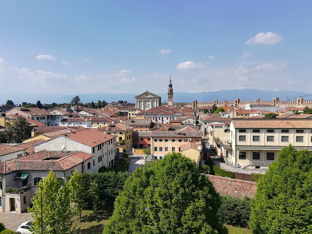
| View from Sant'Agata Feltria's castle |
 |
| The castle of Sant'Agata Feltria |
 |
| Weed covered houses |
 |
| The foggy atmosphere before reaching the town of Balze |
 |
| Sunny view of the landscape around Balze |
 |
| The rocky outcrop above Balze |
 |
| A horse grazing among the verdant fields of the Apennine Mountains |
 |
| The rocky formation of the Sanctuary of La Verna |
 |
| View of the surrounding landscape |
 |
| La Verna's sanctuary |