Tuesday, July 15, 2025

Zittau Mountains (24/08/2024)

On a day trip, Ania and I decided to head south to Saxony to an area known as the Zittau Mountains. This hilly area which reaches a maximum elevation of 793m is located in the southeastern part of the state and straddles the the Saxon-Bohemian border. After taking a couple of trains we switched to a bus and then reached the town of Oybin. Scenically set in a small valley surrounded by these hills with the typical and beautiful sandstone formations, it has been a popular spot for 19th-century romantic painters such as Caspar David Friedrich as well as a place for rest and recuperation being a Kurort, a certified spa resort. We walked through the tiny town center and started ascending the hill named like the town. Shortly up our climb, we came upon the Bergkirche, a beautiful baroque church built in 1734. Its peculiarity was that the interior followed the slope of the hill and thus had a kind of gradient seating from the door down to the high altar. Furthermore, it was beautifully decorated with wooden painted fittings. Continuing on up we then passed through the sandstone formations, sided by tall pillars and walls of stone. We took some of the most scenic narrow passes through these formations which like others in the area have always enticed me. Eventually, after the climb we reached the hilltop at about 514m where the castle and monastery of Oybin are located. The castle was originally built during the 14th century and then the Holy Roman Emperor Charles IV had an imperial house built here as well as a monastery which was given to the Celestine order. During the Hussite Wars, the castle was attacked but managed to resist. However, with the Reformation the monastery was dissolved and the slow decay began. Following heavy damage during the 16th century by lightning and then rockfall in the 17th century, the whole complex was abandoned and later used as a quarry. In the 19th century, the place attracted Romantic painters such as Caspar David Friedrich and Carl Gustav Carus, as well as others, who made the picturesque ruins famous around the world with their landscapes. After paying for the ticket we entered the complex and followed the main path going through a first and then second gate. At the top we entered the church, still featuring the exterior walls but without a roof. It was a beautiful example of Gothic architecture in which master builders from the Prague Cathedral participated. The place was made even more beautiful by a violinist and piano player playing music inside the nave. Climbing the partly surviving southern tower to the top we then also had a great view of the ruins, and surrounding rocky and mountainous landscape. Back down we then visited the rest including the castle part with the imperial house, as well as the picturesque cemetery, and the high point of Oybin Hill. From here we had an amazing view and in the distance could easily make out the city of Zittau. Particularly nice was also the view from the cemetery of the church and castle built on the cliffside over a deep rocky ravine. After visiting the complex we headed back into town and then walked through to start our ascent of the next set of hills. The climb was quite easy and consistent, eventually leading to the Töpfer a 582m high hill. Here was a mountain hut packed with people as well as a flat part of the rocks with a cross and an incredible view. Straight ahead was the city of Zittau and the plains surrounding it while to the right was the Turów Coal Mine and thermal power station of the Polish town of Bogatynia and further the Czech Jizera Mountains. After enjoying the view we walked along the ridgeline admiring many rock formations which here take all kinds of shapes and forms and get funny names such as the Brooding Hen, the Turtle, or the Parrot. Walking along the ridgeline we saw some nice viewpoints among the rock formations and admired the panorama mostly facing toward Czechia, but with the occasional viewpoint of Oybin as well. We followed the path heading downhill until we crossed a road and followed the path back up another hill. We reached the top at an altitude of 749m where a 25m high stone lookout tower was built at the end of the 19th century. Some few hundred meters away, on a twin peak, we then reached a mountain hut with a beautiful viewpoint. Here ran the border line between Germany and Czechia and from the Czech side of the hut a lookout provided an amazing view of the Czech hilly landscape. From there, after enjoying the view we walked downhill on the other side and reached the village of Hain. We continued walking through nice countryside and thick forest until we reached another area with rocky formations. The site used to have quarries and we passed an old wooden smithy, before walking through a man-made path sided by high rock walls and a viewpoint. Here down below was the Schwarzes Loch, or black hole, a 50m deep rock cauldron with high walls only accessible through a rock-cut staircase and like others in the area used as a quarry. We continued on along the path and saw other rock formations, like the ones from before, with interesting names such as the large and small organs due to them looking like organ tubes. After reaching the border once again we followed the path around a gorge and eventually reached the last large rock formation, the Nonnenfelse, or Nuns' Rock. A steep stone staircase led up, sided by tall rock walls to the top of the formation. A hut was located here but it had unfortunately closed, as we had hoped to get a beer or something to snack. Nevertheless, we enjoyed the view from the top with the light turning golden as the sun was starting to go down. After a walk through some more scenic rocky outcrops, we eventually headed downhill and reached the town of Jonsdorf just in time to catch our bus and then later train back home.

Old townhouse in Oybin

The Bergkirche

Entrance to the monastery castle

The ruins of the church

View form the top

Gothic windows

The cemetery next to the church

View of the cliffs below the monastery castle

The Töpferbaude inn

View towards Zittau

The trail through the forest

View towards Oybin

The Schwarzes Loch

The stairs to the Nonnenfelsen

View from the top of the Nonnenfelsen


Monday, July 14, 2025

Greiffenberg (23/08/2024)

After work, I decided to head north of Berlin and visit a small town called Greiffenberg, particularly for its castle ruin. After getting on a train and then a bus I eventually reached the destination. Once there, I walked eastwards through town until I reached the edge where, on a small hilltop were the ruins of the Greiffenberg Castle. Built in the 13th century in typical red brick it suffered destruction during the Thirty Years' War and never recovered from that. As I approached it I admired the partly surviving large gatehouse as well as the 12m stump of what was once a much taller keep tower. I enjoyed walking around the area admiring the architecture as well as the surrounding scenery with no one around to disturb me on this late warm summer day. Heading back into town I then tried visiting the town church, located on the hillside on the highest point in town. Rebuilt around 1724 over a previous 13th-century medieval building, like the castle, it was damaged during the Thirty Years' War and thus had to be rebuilt in the 18th century. Unfortunately, as I approached the church I found it closed so I continued on. I walked through the rest of town, reaching the western part of time, before finally deciding it was time to head back. I got back into town and waited for the bus to eventually take me back. 

The countryside around Greiffenberg

The stump of the keep tower

Ruins of the castle

The town church

A street in the old town


Wednesday, July 9, 2025

Eisenhüttenstadt (22/08/2024)

After work, I decided to head east and visit a town on the border with Poland, Eisenhüttenstadt. The town is actually split into two separate towns. The present-day town was in fact founded, together with a huge steel mill, as a socialist model city in 1950 following a decision by the East German Government. It was built next to and around the old town of Fürstenberg, on the Oder River. As the town's population grew rapidly in the 1950s and 1960s, it was renamed Stalinstadt following the death of Joseph Stalin. However, not long after, in 1961, during de-Stalinization, the town was renamed Eisenhüttenstadt. After German reunification in 1990, the state-owned steel works were privatized, and most of its 12,000 employees lost their jobs. Today the city has lost many inhabitants since its heyday and is basically composed of two parts, the Socialist city with its plattenbau buildings and wide long streets and the steelworks to the west, and the old town on the riverside. My aim was to visit the old town and so from the train station located midway between the two parts I headed eastwards. Once I reached the old town though I continued on and walked on top of the Neue Deichbrücke, over the Oder-Spree canal. I reached a small piece of land which I then walked across to eventually reach a small beach on the Oder River. Across, on the other side, in Poland, were the ruins of the Klopot bridge, once a major bridge but destroyed by Germans in 1945 to try to stop the Soviet advance. At that point, I turned around and headed back into town. Once I reached the old town, I first tried visiting the church of St Nikolai, built in the 14th century in a gothic brick style, but unfortunately found it closed. I thus continued on, walking along the main street sided by some old tenement house, and eventually reached the main square. Originally dating to the founding of the city, it first burned in a fire in the 16th century and was again refurbished around 1900 in a neo-renaissance style. Nowadays it is not used as a town hall as the current building is located in the more modern socialist part of the city. After a round through the old town, I decided to head back, eventually getting to the train station for my ride home.

The old town of Fürstenberg

The Oder River

The ruins of the Klopot bridge

View of Fürstenberg

The church of St Nikolai

The town hall


Friday, July 4, 2025

Ziesar (20/08/2024)

After work, I decided to take advantage of the nice weather and go visit the town of Ziesar. Leaving Berlin I took a train and then switched to a bus, eventually reaching the aforementioned town. I got off in the town center and headed to visit the parish church, St. Crucis. Built in a Romanesque style in the 13th century it was refurbished and thus its interior is more modern. From the church, I then walked over to the town's main monument, the castle. Located on the southern side of town it features a fortified complex with surviving walls, several buildings, a church, and the keep tower. Originally dating to the 10th century, it was then rebuilt starting from the 13th century in current Romanesque brick style. The castle served the bishops of Brandenburg as a residence from the 14th to the 16th century, however, once the reformation happened the era of Ziesar as a bishop’s residence came to an end. The castle, then remained the administrative seat until 1819, before moving into private hands until it was nationalized after the war in 1945. From the 1950s to the 1990s, the castle served educational purposes and included a boarding school. Nowadays it hosts a museum which I went to visit. I first climbed to the top of the 35m high fieldstone keep from where I had a great view of the complex. the town and the surrounding landscape. Then I headed to the main building where the museum was laid out. The kind lady at the entrance gave a pamphlet that detailed the exhibits in English. Among the modernized rooms were traces of the old structures including the medieval heating system below the floor, romanesque and gothic window arches, and other building features. As I walked through the rooms I admired the medieval artifacts including a 12th-century baptismal font and a 14th-century crucifix. A highlight was the so-called Jerusalem room, which featured partially surviving faded wall paintings from the 13th to the 15th centuries featuring Jesus, saints, and buildings, rivers, and streets hypothesized to represent the holy city. Also on the lower floor, another room features some nice and well-preserved 15th-century paintings. Next up I then visited the adjoining castle chapel, dedicated to St Peter and Paul. Built around 1470 in a brick gothic style its exterior is typical of Brandenburg however its interior is a marvel unlike others in the region. In fact, its beautifully preserved paintings from around 1500 decorate the ceiling and walls with green, blue, and red hues symbolizing the greenery of the Garden of Eden, the blue of heaven, and the red of masonry. It also features large paintings in the three left wall niches depicting Jesus, Madonna, and some kind of paradise tree. After visiting the church I headed back into the main building and completed the tour of the museum by visiting the remaining rooms that held a temporary exhibit with late 19th and early 20th century paintings of surrounding landscapes and towns including Ziesar itself. Heading out I then left the castle courtyard and walked around the complex admiring it from different points and perspectives. I then passed by the Storchenturm, a brick tower, and the only surviving part of what was once the outer wall of the castle. It is now standing solitary a few meters from the entrance but surrounded by a nice park. From there I then headed through town, walking along its main street acting as a kind of elongated square, the Breiter Weg, sided by old houses and buildings. Like other parts of Brandenburg and beyond it was sad to see many were empty, with the store signs faded and dating to many years back. Eventually I reached the bus stop and got my ride back to Berlin.

The church of St Crucis in Ziesar

Old town houses

View of the town from the top of the keep

The castle chapel

View of the castle and keep

The Storchenturm

View of the castle complex


Tuesday, July 1, 2025

Trip around northern Friuli (10/08/2024)

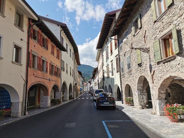
 Ania and I did a day trip in northern Friuli visiting a few places along the way. Our first stop was the town of Clauzetto, known as the balcony of Friuli due to its location on hilly terrain at around 558m surrounded by mountains and with a view of the plains. Once there we walked around town admiring the views and reached the main church, San Giacomo, a little aways from the center, on a hilltop dominating the landscape. Built in the 17th century it features a wide facade and a bell tower from a century later. Unfortunately, it was closed so we retraced our steps back to town and stopped at the only bar in town for breakfast. After eating we drove to the nearby Pradis Caves where we parked the car and bought our ticket as soon as the site opened. We were the first ones in and enjoyed it a lot as it was never crowded during our visit. The caves are quite popular and on a hot August weekend day such as that can become quite crowded. Opened to the public in the 1960s the caves which actually are made up of a series of caves and a gorge are an important site and human and animal traces dating all the way back to the Paleolithic time were found there. We descended the 207 steps leading down to the gorge formed by the Cosa River and walked through the wooden walkways leading along the canyon. We admire beautiful rock formations and incredible views of the gorge. In addition, we followed the pathway leading to tunnels and smaller caves and then to the main cave, that of the Madonna, quite large and with a statue of Mary as it was a site of devotion. After the nice visit we headed back up to the car and then a short drive led us to the Ceconi Castle. This castle was built in 1908 in a neogothic style by Giacomo Ceconi, a building contractor, who became rich by building railroad lines during the 19th century. Set on a plateau surrounded by mountains it has a beautiful view and we were able to access it freely as it hosted an art exhibition inside. Nearby in the small town of Pielungo, we tried visiting the church of Sant'Antonio also built by Ceconi. It was closed so we continued on, heading downhill and then stopping along the road where many cars were parked. Here a short descent led us to the Curnila, a series of pools created by the Arzino river which have beautiful crystal clear waters. The place was already quite full of people but we just wanted to see it instead of staying there and having a swim in the frigid waters before heading onwards. As we drove onwards we started heading uphill along the arzino valley. At one point we reached a beautiful area surrounded by mountains and with a view of even more mountains in the distance. Stopping in a small town called Chiaicis we decided to have lunch in a place called Al Borgo which had also vegan and vegetarian food. Ania had polenta with falafel, lentils, and beans while I had frico, a type of grilled potato and cheese with polenta. Nearby we then visited the Verzegnis Lake, an artificial lake with a beautiful view of Mount Amariana not far ahead. After visiting the lake we headed downhill and reached the valley, formed by the flow of the Tagliamento river. Once we crossed it we reached the city of Tolmezzo. We parked the car and continued on foot visiting its pretty historic center. First, we headed uphill until we reached the Picotta Tower, built in 1477 but destroyed by Germans in 1944 during WWII. It was later rebuilt and provides a beautiful view of the surrounding mountainous landscape and the city itself which we enjoyed for a while. Heading back down into town we walked along the main street lined by porticoes and old buildings and reached the other end of town. Here was the Museo Carnico delle Arti popolari, a museum of local folk art, hosted inside the 17th century Palazzo Campeis. We decided not to visit the museum but instead just check out the palace's courtyard which featured some exhibits such as wellheads, wooden utensils, etc. Walking further we then reached and entered the Duomo, built in the 18th century to replace a smaller older church. At the southeastern end of town, we reached the Porta di Sotto, the only surviving city wall part of the medieval wall that once surrounded the city. Back in town we then visited the other church, Santa Caterina, once dating to the 15th century but completely rebuilt in the 18th century. After the stroll, we got back to the car and drove uphill to reach the town of Illegio. Here after parking the car, we strolled through the town with its stone houses and wooden architecture set on a plateau surrounded by mountains. We passed by its main church, San Paolo, dating to the 18th century but found it closed and continued along the picturesque streets admiring also a series of watermills set along the small creek flowing through town. After the visit, we drove back down to the valley and followed it downhill for quite a bit. Eventually, we stopped at the Lago di Cavazzo. the largest natural lake in the region. Located on a depression between the mountains it is a popular tourist spot. Generally, its southern side, as it is flat and has infrastructure is quite busy, but we stopped the car on its eastern side which has a slope heading down to the lake. From the parking lot along the road, we descended a path and reached the lake's shore. Here we laid our towels and had a little nap. Then I decided to take a swim in the nice clear but cold waters. It was very refreshing and worth it especially due to the beautiful scenery around. Once we were done we headed back to the car but only at the top did I realize I had left my swimsuit to dry by the lakeshore. I ran back down and then up I went once again. For the last of the day, we then drove to Udine. I had been here several times but Ania hadn't and as it was one of the partner universities of our master's studies and quite a nice old town I wished her to see it too, We parked the car in the large square Piazza I Maggio just next to the old town and then had a stroll through the city. We entered through one of the medieval gates, Porta Manin, and then reached the beautiful Piazza della Libertà with the Loggia del Lionello, in a Venetian gothic style, the renaissance Loggia and tempietto di San Giovanni, and the Venetian style clock tower. Moving on we reached another main square, Piazza Giacomo Matteotti, more simple in its style but nonetheless scenic with many bars and restaurants around. As we were getting hungry we decided to look for a place for dinner. We ended up choosing Poke Sun-Rice where we had a poke bowl as we wanted something quick and fresh due to the heat as well. Then we headed back to the large square and stopped for a tasty gelato at Oggi Gelato, and with it in hand continued our stroll through the rest of town. Once back in the car, we started to head back to Jesolo and along the way stopped quickly in Mortegliano which features the tallest bell tower in Italy at 113m. Built in the 1950s it consists of a framework of exposed reinforced concrete beams and pillars while the inner part is light brick masonry. Eventually we got back home satisfied after a long trip. 

View of Clauzetto

The forest around the Pradis Caves

The cave of the Madonna

The gorge formed by the Cosa River

View of the caves

Another section of the gorge

The Ceconi castle

The church of Sant'Antonio in Pielungo

The Curnila pools formed by the Arzino river

The Amariana mount across the Verzegnis Lake

View from the Torre Picotta in Tolmezzo

A street in Tolmezzo's old town

Another street in the old town

The main street

View of Illegio

Piazza della Libertà in Udine with the castle and Loggia San Giovanni

Piazza Giacomo Matteotti

A street in the old town

Mortegliano's bell tower, Italy's tallest